
Bunurong/ Boonwurrung Place Names
Place Names Across Bunurong and Boonwurrung Country: Language, Law, and Landscape
MLA Educational Series — Kulin Nation: Sea Country and the Memory of Land
Place names are vessels of memory, carrying law, science, and identity. For the Bunurong (Boonwurrung) people — the southernmost language group of the Kulin Nation — each name encodes a story about Sea Country, sky, and living systems. Stretching from the Werribee River and Port Phillip Bay (Nerm) across the Mornington Peninsula, Western Port (Birrarung Warran), Phillip Island (Millowl), and eastward along the Bass Coast to Wilsons Promontory (Yiruk), Bunurong Country is a continuous cultural geography shaped by water, wind, and kinship (Broome, 2005; Clark & Heydon, 2002; BLCAC, 2023).
To speak these names is to hear Country again — to restore stories once silenced by colonisation and to recognise that language itself is an ecological map.
Bunurong Country, Clans, and Language
The Bunurong/Boonwurrung are one of five Kulin language groups, alongside the Woiwurrung (Wurundjeri), Taungurung, Dja Dja Wurrung, and Wadawurrung. Their territory includes the Yallock-Bulluk, Mayone-Bulluk, Ngaruk-Willam, Yowenjerre, and Boakoolawal clans, united under Bunjil’s Law (Blake, 1991; Presland, 1994).
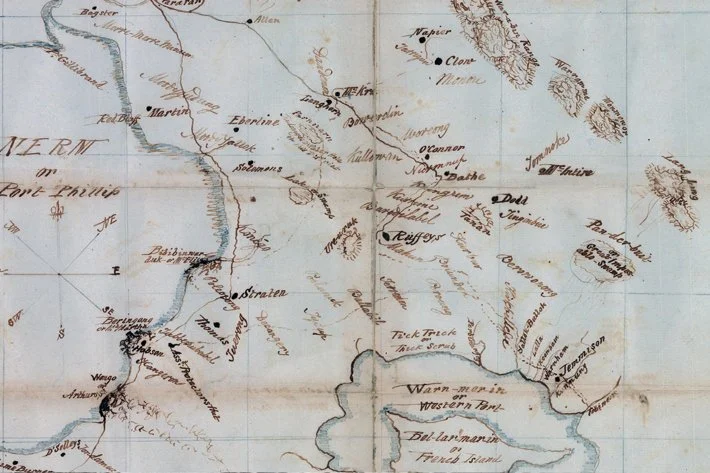
Bunurong and Boonwurrung Place Names and Meanings
Each name listed below appears in linguistic, colonial, or ecological records (Clark, 1990; Clark & Heydon, 2002; BLCAC, 2023). These are the original words of the land and sea — many still remembered and used today.
1. Narrm — Melbourne
Meaning: “Place” or “Country.”
Context: Central gathering ground of the Kulin Nations on the Birrarung (Yarra River).
Significance: A site of diplomacy, ceremony, and trade.
(Broome, 2005; Clark & Heydon, 2002)
2. Birrarung — Yarra River
Meaning: “River of mists” or “ever-flowing river.”
Context: Flows from the ranges through Woiwurrung and Boonwurrung Country to Port Phillip Bay.
Significance: Spiritual and ecological boundary between salt and freshwater.
(Presland, 1994; Clark, 1990)
3. Boonwurrung / Bunurong
Meaning: From boon (no/language) + wurrung (mouth/speech) — “people of the boon-speaking tongue.”
Significance: Denotes both language and identity of the southern coastal Kulin peoples.
(Blake, 1991; Clark & Heydon, 2002)
4. Mooro — Sandridge / Port Melbourne
Meaning: “Sandy ridge” or “place of sand dunes.”
Context: Coastal hunting and shellfish area.
(Clark & Heydon, 2002)
5. Euro-Yroke — St Kilda
Meaning: “Place of the grinding stone.”
Significance: Associated with basalt outcrops used for tool-making.
(Presland, 1994)
6. Nerm — Port Phillip Bay
Meaning: “The quiet water” or “the still bay.”
Context: Central body of Sea Country surrounded by Kulin clans.
(BLCAC, 2023; Clark & Heydon, 2002)
7. Monmar — Point Nepean
Meaning: “Southern point” or “law ground of the sea.”
Significance: Ceremonial site and coastal crossing point into Nerm.
(BLCAC, 2023)
8. Wonga — Arthurs Seat
Meaning: “Place of the wonga pigeon.”
Context: Sacred high ground used for ceremony and navigation.
(Clark & Heydon, 2002)
9. Kangerong — Dromana / Red Hill
Meaning: Possibly “place of kangaroos.”
Context: Freshwater springs and forest hunting grounds.
(Blake, 1991)
10. Moorooduc — Mount Eliza Region
Meaning: “Flat country” or “grassy plain.”
Context: Inland camp area used for travel between bays.
(Clark & Heydon, 2002)
11. Tootgarook
Meaning: “Swamp of reeds” or “croaking of frogs.”
Context: Seasonal wetland marking the rhythm of frog song.
Significance: Indicator of water and seasonal cycles.
(Blake, 1991; Zola & Gott, 1992)
12. Karrum Karrum — Carrum Swamp
Meaning: “Flooded plain” or “boiling waters.”
Context: Part of the Koo Wee Rup wetland complex.
(Clark & Heydon, 2002; DEECA, 2023)
13. Koo Wee Rup
Meaning: “Water of the swamp” or “blackfish swimming.”
Significance: One of Victoria’s largest pre-colonial wetlands; major eel-fishing and fibre-harvesting area.
(Clark & Heydon, 2002; DEECA, 2023)
14. Mordi Yallock — Mordialloc
Meaning: “Little creek.”
Context: Freshwater lagoon system leading to the sea.
Significance: Bunurong camp and later Aboriginal reserve site.
(Presland, 1994; Clark & Heydon, 2002)
15. Warneet
Meaning: “Place of the bay” or “tidal inlet.”
Context: Estuarine system at north-western Western Port.
(Clark & Heydon, 2002)
16. Tooradin
Meaning: From turra-din, “noisy bird,” likely referencing curlews or herons.
Significance: Wetland hunting and gathering site.
(Clark & Heydon, 2002)
17. Balnarring
Meaning: From ballin (camp) + arring (resting) — “camping place.”
Context: Traditional resting site along coastal travel routes.
(Blake, 1991)
18. Merricks Creek
Meaning: “Place of many fish.”
Context: Freshwater and tidal junction linking inland and coastal grounds.
(Clark & Heydon, 2002)
19. Millowl — Phillip Island
Meaning: “Neck of land” or “island.”
Context: Central to Bunurong Sea Country and seasonal muttonbird harvest.
(BLCAC, 2023; Clark & Heydon, 2002)
20. Yallock-Bulluk — Cape Paterson Region
Meaning: “People of the river” (yallock = river, bulluk = people).
Significance: Clan estate and law ground; rich in fossils and coastal food sources.
(VandenBerg, 1999; Broome, 2005)
21. Tarwin — Inverloch and Anderson Inlet
Meaning: From Darowin, “river with many bends.”
Context: Estuarine habitat for eel migration.
(DEECA, 2023; Zola & Gott, 1992)
22. Kugerungmome — Powlett River
Meaning: “Place of she-oak” or “running water.”
Context: Fishing and eel-trapping site.
(Clark, 1990; Morgan, 1852)
23. Kilcunda (Kil-kunda)
Meaning: Possibly “meeting place by the sea.”
Context: Coastal corridor linking clans.
(Clark & Heydon, 2002)
24. Yiruk — Wilsons Promontory
Meaning: “Point of the sea” or “southernmost land.”
Context: Sacred site of ancestral passage shared with Gunai/Kurnai neighbours.
(BLCAC, 2023; Broome, 2005)
25. Wirribi Yalluk — Werribee River
Meaning: “Spine” or “backbone,” describing the river’s shape.
Context: Western boundary between Wadawurrung and Boonwurrung Country.
(Clark, 1990)
Cultural Geography and Ecological Knowledge
Bunurong and Boonwurrung place names reflect an integrated science of language, ecology, and observation.
Yallock identifies water systems;
Bulluk denotes the people who care for them;
Warran refers to the sea;
Ngurrung describes the wind or sky.
Through these naming conventions, ancestors encoded the geography of food sources, wind direction, tide patterns, and seasonal migration. Modern ecological research confirms that many of these named sites align with hydrological basins, groundwater flows, and biodiversity hotspots (DEECA, 2023; Gott & Zola, 1992). The language of place was — and remains — an environmental archive.
Colonisation, Erasure, and Revival
From 1801 onwards, explorers such as Flinders, Bass, and Grant renamed Bunurong landscapes after colonial patrons and officers, replacing living names with foreign designations (Cannon, 1981). This linguistic dispossession severed the link between word and law, obscuring ecological meanings.
However, much was preserved through oral tradition, mission records, and the linguistic work of scholars such as Blake (1991) and Clark & Heydon (2002). Today, the Bunurong Land Council Aboriginal Corporation (BLCAC) collaborates with DEECA and Parks Victoria to restore dual naming and cultural mapping. Initiatives at Millowl, Yiruk, Monmar, and Tarwin reaffirm the power of language to heal both Country and community (BLCAC, 2023).
Conclusion
Across the bays, wetlands, and coastal plains of southern Victoria, Bunurong and Boonwurrung place names endure as a living language of Country. Each name is both geography and law, describing where to find water, how to travel safely, and when to honour the changing seasons.
As these words return to the public domain through truth-telling and education, they re-establish a fundamental truth: the land still speaks in its first language, and those who listen learn how to live within it.
References
Barwick, D. (1998) Rebellion at Coranderrk. Canberra: Aboriginal History Monograph.
Blake, B. (1991) Wathawurrung and the Colac Language of Southern Victoria. Canberra: Pacific Linguistics.
Broome, R. (2005) Aboriginal Victorians: A History Since 1800. Sydney: Allen & Unwin.
Bunurong Land Council Aboriginal Corporation (2023) Bunurong Sea Country and Cultural Heritage Strategy. Melbourne: BLCAC.
Cannon, M. (1981) Life in the Country: Australia in the Victorian Age, 1840–1890. Melbourne: Nelson.
Clark, I.D. (1990) Aboriginal Languages and Clans: An Historical Atlas of Western and Central Victoria, 1800–1900. Clayton: Monash University.
Clark, I.D. & Heydon, T. (2002) Dictionary of Aboriginal Placenames of Victoria. Melbourne: Victorian Aboriginal Corporation for Languages.
Department of Energy, Environment and Climate Action (DEECA) Victoria (2023) Bunurong Marine and Coastal Parks Management Plan. Melbourne: State Government of Victoria.
Gott, B. & Zola, N. (1992) Koorie Plants, Koorie People: Traditional Aboriginal Food, Fibre and Healing Plants of Victoria. Melbourne: Koorie Heritage Trust.
Presland, G. (1994) Aboriginal Melbourne: The Lost Land of the Kulin People. Melbourne: Harriland Press.
VandenBerg, A.H.M. (1999) Geology of Victoria. Geological Society of Australia, Special Publication 10.
Morgan, J. (1852) The Life and Adventures of William Buckley. Hobart: Archibald MacDougall.
Written, Researched and Directed by James Vegter (22 September 2025)
MLA
Sharing the truth of Indigenous and colonial history through film, education, land, and community.
www.magiclandsalliance.org
Copyright MLA – 2025
Magic Lands Alliance acknowledges the Traditional Owners, Custodians, and First Nations communities across Australia and internationally. We honour their enduring connection to the sky, land, waters, language, and culture. We pay respect to Elders past, present, and emerging, and to all First Peoples’ communities and language groups. This article draws only on publicly available information; many cultural practices remain the intellectual property of their respective communities.