
Bunurong/ Boonwurrung Place Names
Indigenous Sea Country, Tides of Lore, and the Estuary of Two Worlds
MLA Educational Series — Bunurong/Boonwurrung Country: Water, Energy, and Balance
Where the tides of Bass Strait surge between Phillip Island and the Mornington Peninsula lies Warn’Marrin, known today as Western Port. For the Indigenous peoples of the Bunurong/Boonwurrung Nation, this great tidal bay is not simply a stretch of water — it is living law, a breathing system connecting land, sea, and sky. With its complex channels, mangrove forests, and mudflats, Warn’Marrin is one of Victoria’s most dynamic coastal environments — a place where ecology, geology, and culture have evolved together over tens of thousands of years (Clark & Heydon 2002; Bunurong Land Council Aboriginal Corporation 2023).
The rhythm of its tides mirrors the breath of Country itself: flowing in balance, sustaining life, and teaching the law of reciprocity.
Name and Cultural Meaning
In the Bunurong/Boonwurrung language, Warn’Marrin translates as “bay of many creeks” or “water of many mouths” (Blake 1991). The name reflects its branching estuarine shape, where freshwater rivers from the Strzelecki foothills and Cardinia plains meet the saltwater tides of the ocean. Historically, the Warn’Marrin region was home to several interrelated clans, including Yallock-Bulluk, Mayune-Bulluk, and Ngurrak-Bulluk, whose kinship and ceremony formed part of the broader Kulin Nation (Clark 1990; Broome 2005). These communities lived according to the principle of biik-warran-ngurrara — the unity of land, sea, and sky — in which every movement of water or wind carried moral and environmental law. Elders describe the bay as a teacher that “remembers everything that flows through it,” a reminder that all life is part of a continuous cycle of giving and return.
Geology and Deep Time of the Bay
The story of Warn’Marrin begins deep in geological time. Around 10,000 years ago, rising seas flooded an expansive plain that once linked the mainland to Phillip Island and French Island — part of the ancient Bassian Land Bridge (VandenBerg 1999; Ryan 2012). The region’s foundations are built from ancient volcanic rocks, overlain by marine clays and peat sediments that record the gradual rise of the ocean after the last Ice Age. For the Bunurong/Boonwurrung, this transformation was a moment of creation. Oral traditions describe how the creator Bunjil opened the sea’s mouth to bring balance back to the land.
What Western geology calls marine transgression, Indigenous knowledge remembers as the return of the sea’s breath — both describing the same environmental truth from different systems of observation and law.
Ecology and the Living Estuary
Warn’Marrin remains one of Australia’s most significant tidal estuarine ecosystems, shaped by strong currents and large tidal ranges. Its landscapes of mangrove, seagrass, and saltmarsh form vital habitats for marine and birdlife (Parks Victoria 2023; DEECA 2023).
The system supports:
Grey mangroves (Avicennia marina), the southernmost mangroves in the world, which anchor sediment and provide shelter for juvenile fish and crustaceans.
Seagrass meadows, essential for oxygen production and breeding grounds for flathead, rays, and pipefish.
Migratory shorebirds, including Eastern Curlews and Red-necked Stints, protected under international Ramsar agreements.
Short-finned eels (kooyang), whose migration between inland waterways and the Coral Sea forms part of both ecosystem cycles and Indigenous seasonal law (Zola & Gott 1992; Presland 1994).
To the Bunurong/Boonwurrung, these tidal and biological processes express Ngurrara, the Law of Balance — the understanding that every flow of water or energy must give back to what it takes.
This alignment of Indigenous ecological ethics with modern coastal science demonstrates an ancient environmental philosophy grounded in sustainability.
Cultural Life on the Tidal Plains
Before colonisation, Warn’Marrin supported a rich and interconnected Indigenous economy. Seasonal camps lined the creeks at Tooradin, Lang Lang, and Bass, where families harvested fish, shellfish, and swan eggs, while trading stone tools and ochre with neighbouring Kulin groups (Broome 2005). Stone fish traps, brush fences, and woven nets guided fish with the falling tide — technologies perfectly adapted to tidal flow and lunar cycles (Clark & Heydon 2002; Presland 1994). Shell middens and hearths found along the shores of Corinella, Rhyll, and French Island contain thousands of years of cultural evidence, showing a continuous relationship between people and place. The act of navigating these tidal waterways by canoe, star, and current was more than practical — it was ceremonial. Every journey through the bay re-enacted ancestral law: the movement of spirit through space, the flow of kinship through water.
Lore of the Tides: Physics and Philosophy of Flow
Warn’Marrin experiences one of the largest tidal ranges in southern Australia, with a difference of more than two metres between high and low tide. Modern oceanography describes this as a semi-diurnal tidal basin, where strong reversing currents pass through the narrow entrances between San Remo and Hastings (DEECA 2023). For the Bunurong/Boonwurrung, this was read through sound, colour, and texture: the hiss of mud as the water recedes, the change in light as the tide turns, and the shift in bird behaviour before a storm. This deep observation formed what can be called Indigenous coastal physics — a knowledge system derived from direct engagement with natural forces. Where science measures wave energy and sediment flux, Indigenous law interprets the same processes as the breath and balance of the sea.
Both perspectives describe energy transfer, feedback, and renewal — confirming that sustainability depends on the flow of exchange between land and ocean.
Colonial Contact and Transformation
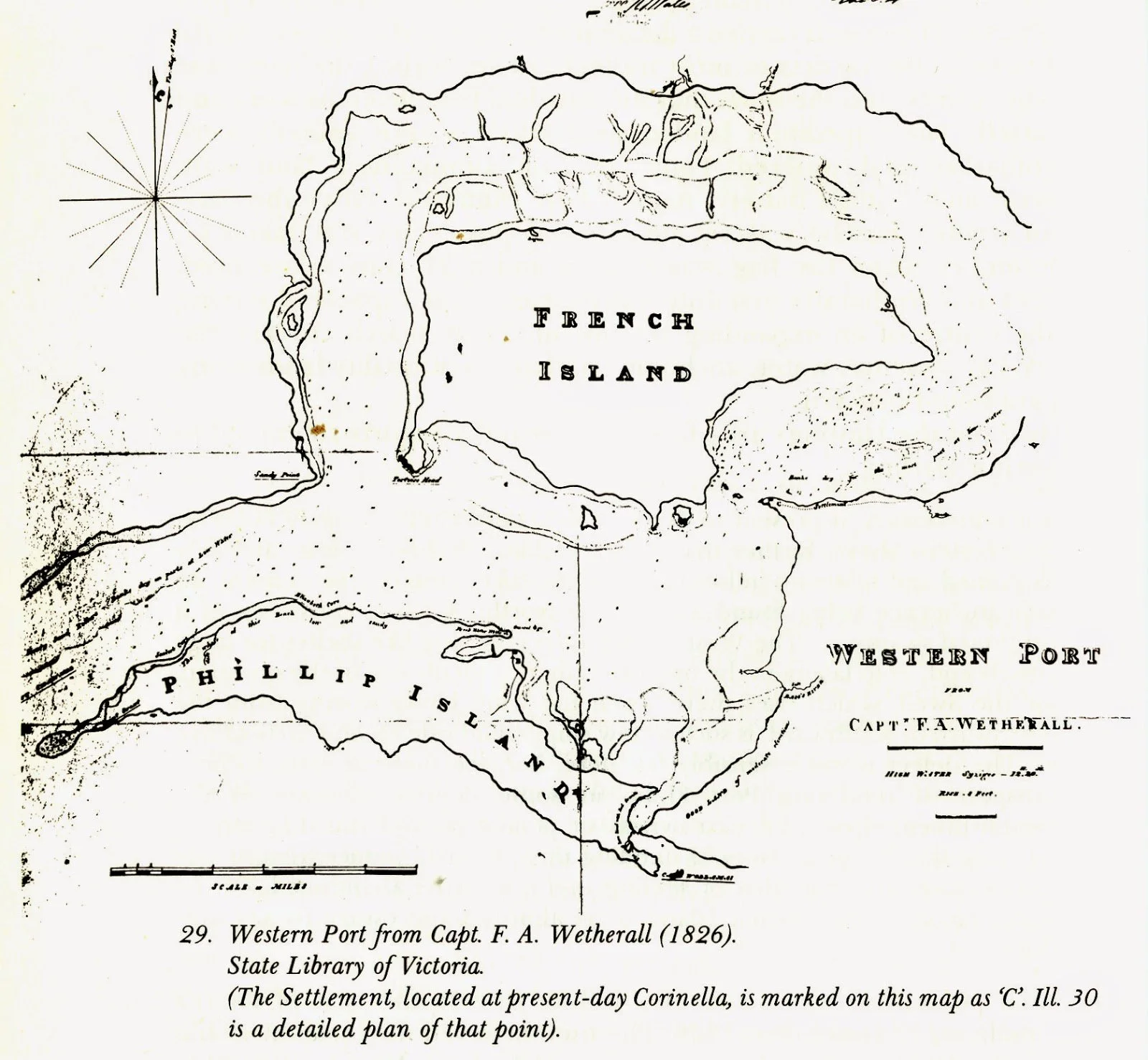
The colonial name “Western Port” was given by Lieutenant James Grant in 1801 aboard the Lady Nelson, reflecting British navigational claims rather than Indigenous geography (Cannon 1981). By the 1820s, the area became a focus for settlement, beginning with the Corinella military outpost in 1826 — the first British base in Victoria. Subsequent pastoral expansion, timber cutting, and lime production rapidly damaged wetlands and sacred sites. Drainage works altered natural waterways, and mangrove forests were cleared for shipping and grazing. By the mid-1800s, Bunurong/Boonwurrung families were displaced from their coastal estates, with survivors moved to missions at Mordialloc and Coranderrk (Barwick 1998; Broome 2005). Yet, oral traditions and place names preserved the memory of Country.
The principle “never take more than the tide gives” continued to guide cultural teachings long after colonisation reshaped the shoreline.
Environmental and Cultural Restoration
Today, Warn’Marrin is recognised as both a Ramsar-listed wetland and an Indigenous cultural landscape jointly managed by the Bunurong Land Council Aboriginal Corporation (BLCAC), Parks Victoria, and DEECA.
Key restoration projects include:
Rehabilitation of mangrove and saltmarsh habitats for carbon capture and coastal protection.
Cultural Waterway Assessments, combining Indigenous ecological indicators with hydrological data.
Dual naming and language renewal, reinstating Indigenous place names at sites across the bay.
On-Country education programs, teaching tidal observation, eel migration, and sea law to schools and community groups (BLCAC 2023; DEECA 2023).
These efforts are grounded in the Bunurong/Boonwurrung philosophy biik-bunurong wurrung-gi — Country and language heal together — showing how environmental science and Indigenous law can work as one.
Cultural Physics: The Lore of Balance
In both Indigenous philosophy and environmental science, flow maintains equilibrium. When energy and matter circulate freely, ecosystems thrive; when they stagnate or are obstructed, imbalance follows.
This understanding mirrors the scientific principle of dynamic equilibrium, which states that all systems maintain stability through constant movement. Warn’Marrin exemplifies this relationship. Each tide replenishes what the last removed; each river shapes the bay that in turn shapes the land. This reciprocal flow — spiritual, ecological, and physical — forms the essence of the Law of Balance that has guided the Bunurong/Boonwurrung since time immemorial.
Conclusion
Warn’Marrin, or Western Port, remains a living embodiment of Indigenous Sea Country. It is a place where the physics of the tide and the ethics of law converge — reminding all who visit that Country is not a static resource but a dynamic, breathing system of relationships. Through renewed partnerships between Traditional Owners, scientists, and conservationists, the tides of Warn’Marrin once again carry stories of care, knowledge, and continuity. The message of this Country endures: when we respect the flow, life restores itself.
References
Barwick, D. (1998) Rebellion at Coranderrk. Canberra: Aboriginal History Monograph.
Blake, B. (1991) Wathawurrung and the Colac Language of Southern Victoria. Canberra: Pacific Linguistics.
Broome, R. (2005) Aboriginal Victorians: A History Since 1800. Sydney: Allen & Unwin.
Bunurong Land Council Aboriginal Corporation (2023) Bunurong Sea Country and Cultural Water Plan. Melbourne: BLCAC.
Cannon, M. (1981) Life in the Country: Australia in the Victorian Age, 1840–1890. Melbourne: Nelson.
Clark, I.D. (1990) Aboriginal Languages and Clans: An Historical Atlas of Western and Central Victoria, 1800–1900. Melbourne: Monash Publications in Geography.
Clark, I.D. & Heydon, T. (2002) Dictionary of Aboriginal Placenames of Victoria. Melbourne: Victorian Aboriginal Corporation for Languages.
DEECA Victoria (2023) Marine and Coastal Policy: Western Port and Bunurong Marine Parks. Melbourne: Department of Energy, Environment and Climate Action.
Parks Victoria (2023) Western Port Ramsar Site Management Plan. Melbourne: State Government of Victoria.
Presland, G. (1994) Aboriginal Melbourne: The Lost Land of the Kulin People. Melbourne: Harriland Press.
Ryan, L. (2012) Tasmanian Aborigines: A History Since 1803. Sydney: Allen & Unwin.
VandenBerg, A.H.M. (1999) Geology of Victoria. Geological Society of Australia, Special Publication 10.
Zola, N. & Gott, B. (1992) Koorie Plants, Koorie People: Traditional Aboriginal Food, Fibre and Healing Plants of Victoria. Melbourne: Koorie Heritage Trust.
Written, Researched and Directed by James Vegter (22 September 2025)
MLA
Sharing the truth of Indigenous and colonial history through film, education, land, and community.
www.magiclandsalliance.org
Copyright MLA – 2025
Magic Lands Alliance acknowledges the Traditional Owners, Custodians, and First Nations communities across Australia and internationally. We honour their enduring connection to the sky, land, waters, language, and culture. We pay respect to Elders past, present, and emerging, and to all First Peoples’ communities and language groups. This article draws only on publicly available information; many cultural practices remain the intellectual property of their respective communities.