
Bunurong/ Boonwurrung Place Names
Place of Shelter: History, Meaning, and the Spirit of the Coast
MLA Educational Series — Bunurong/Boonwurrung Country: Earth, Energy, and the Law of Balance
On the southern edge of Victoria, where the green hills of South Gippsland meet the wild wind of Bass Strait, lies Wonthaggi — a town whose name and story reflect both resilience and change. Today known for its coal mining heritage and close proximity to the ocean, Wonthaggi sits within the ancestral lands of the Bunurong/Boonwurrung people, the Traditional Custodians of this Country. Long before mining, Wonthaggi was part of a living landscape of water, dunes, and forest — a vital link between the inland ranges and the coastal plains of Tarwin-Murrum and Cape Paterson (Clark & Heydon 2002; Bunurong Land Council Aboriginal Corporation 2023). To the Bunurong/Boonwurrung, this region was a place of gathering and shelter — where freshwater met salt, where people rested between journeys, and where the law of balance between earth, sea, and sky could be seen in motion.
The Meaning of Wonthaggi
The name Wonthaggi is derived from an Indigenous word from the Bunurong/Boonwurrung and Gunai/Kurnai languages, believed to mean “shelter,” “home,” or “to get shelter” (Blake 1991; Clark & Heydon 2002). This meaning is particularly fitting for a place shaped by fierce winds and coastal storms. The word conveys a deep sense of refuge — not only physical but spiritual. In Indigenous philosophy, shelter is not merely protection from weather; it is harmony with the elements, achieved through respect and awareness of their patterns.
Elders describe Wonthaggi’s meaning as a reminder that Country provides balance when people act in alignment with its law. The dunes, forests, and estuaries once offered natural protection — hollowed dunes for camps, tea-tree thickets for windbreaks, and freshwater springs for sustenance. These landscapes embodied what the Bunurong/Boonwurrung call biik ngarra, the unity of land and spirit. When settlers later adopted the word “Wonthaggi” for the coal mining township established in 1909, they unknowingly carried forward an ancient concept of refuge — though one reinterpreted through the lens of industry and survival.
Geology and the Shape of the Country
Wonthaggi sits within one of Victoria’s most geologically diverse coastal regions. Beneath its sandy surface lie layers of Cretaceous sandstone, basalt, and rich seams of black coal, formed from ancient forests that grew more than 120 million years ago when Australia was part of Gondwana (VandenBerg 1999). Tectonic uplift and erosion exposed these layers near the coast, creating the distinctive rolling hills and coal-bearing cliffs that stretch between Cape Paterson, Inverloch, and the Strzelecki foothills.
Before mining, the land supported dense wetlands, coastal woodlands, and rich estuarine ecosystems fed by the Powlett River and surrounding creeks (DEECA 2023). For the Bunurong/Boonwurrung, these waterways formed part of a living network of energy and movement connecting inland forest to Sea Country. They were read as signs of the land’s pulse — indicators of seasonal change, fish migration, and ceremony. Modern hydrology confirms the same truth: Wonthaggi sits within a natural catchment that cycles energy and nutrients from hill to sea, maintaining ecological balance through continuous flow.
Indigenous Life and Sea Country
Long before European settlement, the Bunurong/Boonwurrung people lived across the Wonthaggi coast as part of the Yallock-Bulluk and Mayune-Bulluk clans of the Kulin Nation. The nearby Powlett River (Kugerungmome), Anderson Inlet, and Cape Paterson (Yallock-Bulluk Country) were central to life, story, and ceremony (Broome 2005; Clark & Heydon 2002).
Families camped along riverbanks and dunes, building shelters from bark, tea-tree, and reeds. They fished for eels and bream, gathered shellfish, and hunted kangaroo and wallaby across the coastal plains.
Ceremonies were held to honour the spirits of water and wind, acknowledging that every creature and current carried purpose. The seasonal return of short-finned eels (kooyang) was celebrated as part of the law of return — the understanding that all life must give back to what sustains it (Zola & Gott 1992; Presland 1994).
The coast near modern Wonthaggi was also a navigation and teaching site. Elders used the stars, tides, and bird behaviour to predict weather and fish movement — a form of applied science refined over countless generations. These teachings continue today as part of Bunurong/Boonwurrung cultural education and environmental monitoring programs (Bunurong Land Council Aboriginal Corporation 2023).
Colonial Contact and the Birth of the Coal Town
European settlement along the Bass Coast began in the mid-1800s, as pastoralists moved east from Western Port in search of grazing land. Early settlers recorded Indigenous camps and meeting grounds along the Powlett River and nearby creeks but often misinterpreted them as signs of nomadism rather than sophisticated seasonal management (Clark 1990; Broome 2005).
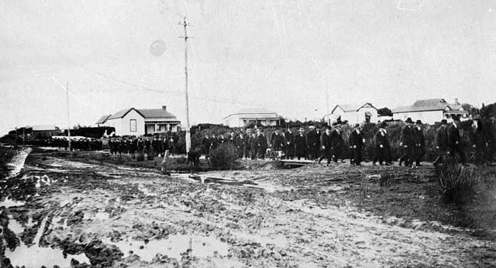
By the late nineteenth century, surveyors discovered extensive coal seams beneath the hills around Wonthaggi. In 1909, the State Coal Mine was established to supply fuel for Victoria’s expanding rail network (Cannon 1981). The new township adopted the local Indigenous name “Wonthaggi,” linking the industrial settlement to the surrounding Country, though few at the time understood its meaning.
The town quickly grew into one of Victoria’s most important energy centres, with thousands of workers and their families living in company-built cottages.
Yet beneath this industrial progress lay a deeper loss: the original ecosystems and sacred sites were cleared or buried under infrastructure, and the waterways that once sustained Indigenous life became channels for industry.
Still, the idea of shelter endured. The coal miners of Wonthaggi — many of whom lived in harsh, exposed conditions — came to see their town as a place of refuge and solidarity. The meaning of Wonthaggi evolved, echoing the Bunurong/Boonwurrung understanding that strength is found in community and in harmony with one’s environment, even when that environment is transformed.
Post-Industrial Transformation and Ecological Renewal
The State Coal Mine closed in 1968, marking the end of an era. The closure left behind both environmental scars and opportunities for renewal. Over the following decades, the abandoned mine sites were revegetated, and the Wonthaggi Heathlands and Coastal Reserve were established to protect native flora and fauna (Parks Victoria 2023). The coastline, once mined and grazed, has regenerated into one of southern Victoria’s most important biodiversity corridors.
For the Bunurong/Boonwurrung, this renewal carries profound cultural significance. The return of plants, birds, and water has allowed ceremonies and educational programs to resume on Country, connecting young people with the old stories of balance and flow. Collaborative projects between the Bunurong Land Council Aboriginal Corporation (BLCAC), DEECA, and Parks Victoria focus on cultural mapping, language restoration, and community conservation (BLCAC 2023; DEECA 2023).
Modern Wonthaggi is therefore a place where Indigenous knowledge and scientific ecology work together — a new expression of the ancient law that all systems thrive through exchange, not exploitation. The town’s transformation from coal pit to cultural and environmental centre symbolises both resilience and reconciliation.
Lore of Shelter: Cultural Physics of Balance
The meaning of Wonthaggi — “shelter” — resonates beyond words. In Indigenous philosophy, shelter is not static protection but a relationship of care between people and place. To find shelter is to be in harmony with Country’s forces — to understand wind direction, water movement, and the energy of the seasons. Environmental science now recognises the same principle. The concept of dynamic equilibrium — that natural systems remain stable through constant adaptation — mirrors the Indigenous Law of Flow (Ngurrara), which teaches that change and movement are essential to life (DEECA 2023). In both views, Wonthaggi’s landscape embodies resilience. Its dunes shift and heal, its creeks cut new paths, and its community continues to rebuild. The town’s story teaches that balance cannot be forced; it must be lived.
Conclusion
Wonthaggi’s history — from ancient Songline to mining frontier to modern coastal town — reflects the ongoing dialogue between people and Country. Its name, meaning “shelter,” speaks to the enduring spirit of refuge that runs through the land and its communities.
For the Bunurong/Boonwurrung, Wonthaggi remains part of a living cultural landscape that connects mountain, river, and sea. For the wider community, it stands as a symbol of transformation — from extraction to restoration, from separation to connection.
The town’s story reminds all who live there that true shelter is not built from walls, but from understanding and respect for the living world. When Country is cared for, it shelters all who belong to it.
References
Barwick, D. (1998) Rebellion at Coranderrk. Canberra: Aboriginal History Monograph.
Blake, B. (1991) Wathawurrung and the Colac Language of Southern Victoria. Canberra: Pacific Linguistics.
Broome, R. (2005) Aboriginal Victorians: A History Since 1800. Sydney: Allen & Unwin.
Bunurong Land Council Aboriginal Corporation (2023) Bunurong Sea Country and Cultural Water Plan. Melbourne: BLCAC.
Cannon, M. (1981) Life in the Country: Australia in the Victorian Age, 1840–1890. Melbourne: Nelson.
Clark, I.D. (1990) Aboriginal Languages and Clans: An Historical Atlas of Western and Central Victoria, 1800–1900. Melbourne: Monash Publications in Geography.
Clark, I.D. & Heydon, T. (2002) Dictionary of Aboriginal Placenames of Victoria. Melbourne: Victorian Aboriginal Corporation for Languages.
DEECA Victoria (2023) Marine and Coastal Policy: Bunurong Marine and Coastal Parks. Melbourne: Department of Energy, Environment and Climate Action.
Parks Victoria (2023) Wonthaggi Heathlands and Coastal Park Management Plan. Melbourne: State Government of Victoria.
Presland, G. (1994) Aboriginal Melbourne: The Lost Land of the Kulin People. Melbourne: Harriland Press.
VandenBerg, A.H.M. (1999) Geology of Victoria. Geological Society of Australia, Special Publication 10.
Zola, N. & Gott, B. (1992) Koorie Plants, Koorie People: Traditional Aboriginal Food, Fibre and Healing Plants of Victoria. Melbourne: Koorie Heritage Trust.
Written, Researched and Directed by James Vegter (22 September 2025)
MLA
Sharing the truth of Indigenous and colonial history through film, education, land, and community.
www.magiclandsalliance.org
Copyright MLA – 2025
Magic Lands Alliance acknowledges the Traditional Owners, Custodians, and First Nations communities across Australia and internationally. We honour their enduring connection to the sky, land, waters, language, and culture. We pay respect to Elders past, present, and emerging, and to all First Peoples’ communities and language groups. This article draws only on publicly available information; many cultural practices remain the intellectual property of their respective communities.