
Bunurong/ Boonwurrung Place Names
Heart of the Hills: History, Meaning, and the Law of Country
MLA Educational Series — Bunurong/Boonwurrung Country: Mountains, Water, and the Spirit of Renewal
Nestled among the green hills of South Gippsland, Korumburra stands as both a centre of community and a landscape shaped by deep time. Its rolling pastures, volcanic ridgelines, and mist-filled valleys carry stories far older than the town itself. Long before the arrival of European settlers, this area was part of Bunurong/Boonwurrung Country, a living system of water, fire, and law. The creeks that flow through Korumburra connect inland mountain springs to the tidal wetlands of Tarwin-Murrum and Warn’Marrin (Western Port), forming part of a vast ecological and cultural network that has sustained life for tens of thousands of years (Clark & Heydon 2002; Bunurong Land Council Aboriginal Corporation 2023).
For the Bunurong/Boonwurrung peoples, this region represents the Law of Balance — the principle that all living systems rely on movement, reciprocity, and respect. The hills breathe with the same rhythm as the coast; water, soil, and spirit are part of one continuous story.
The Meaning of Korumburra
The name Korumburra originates from Indigenous language used across the Bunurong/Boonwurrung and neighbouring Gunai/Kurnai areas. Early linguistic records suggest that korumburra or garamburra may translate to “magpie,” “raven,” or “blowfly country,” each linked to the idea of sound and communication (Blake 1991; Clark & Heydon 2002). These translations reveal a deeper layer of meaning — a connection between the voice of Country and the creatures that inhabit it.
The magpie holds special importance within southeastern Indigenous cultures. Known for its dawn song and protective nature, the bird is regarded as a messenger — a being that announces the day and carries lessons between the physical and spiritual worlds (Broome 2005). Its song was once used to mark time, signal ceremony, and interpret changes in weather. In this way, Korumburra can be understood as “the place where Country speaks,” reminding people that land itself has language.
The name reflects the Bunurong/Boonwurrung worldview in which everything — birds, rivers, trees, and stones — holds voice and meaning. To listen to Country is to understand the cycles of nature and one’s responsibilities within them.
Geology and the Shape of the Hills
Korumburra lies within the volcanic uplands of the Strzelecki Ranges, part of a geological system formed by ancient eruptions, tectonic uplift, and erosion more than 90 million years ago (VandenBerg 1999). Beneath its fertile soils are layers of basalt, sandstone, and coal seams that record shifting climates and ecosystems through deep time. These processes created the dark volcanic soils and fertile valleys that have made the region one of Victoria’s most productive agricultural areas.
The town’s landscape is also defined by water. Dozens of small creeks, including tributaries of the Tarwin River, rise from underground springs in the surrounding hills. These waterways form a natural corridor linking mountain forests to coastal estuaries — a system scientists now describe as an integrated catchment, but which Indigenous law has long recognised as the veins of Biik, the living body of Country (DEECA 2023).
For the Bunurong/Boonwurrung, the land’s form is inseparable from its spirit. The hills are the bones of Country, the rivers its blood, and the wind its breath. Together they create balance — the same principle mirrored in modern ecology, which teaches that stability arises through continual movement and exchange.
Indigenous Life and Connection to Country
Before colonisation, the Korumburra region was part of a vast living landscape cared for by the Bunurong/Boonwurrung and neighbouring Brataualung clans of the Gunai/Kurnai Nation. Boundaries were fluid and defined not by ownership, but by relationships, trade, and ceremony (Clark 1990). People moved seasonally through the hills, following the abundance of plants, animals, and fresh water.
During warmer months, families travelled to higher ground to hunt wallabies, possums, and lyrebirds, and to collect berries, native cherries, and honey. In cooler seasons, they followed river valleys toward the coast, harvesting eels and shellfish at Anderson Inlet and Tarwin-Murrum (Zola & Gott 1992; Presland 1994). Seasonal cycles of movement ensured that no place was overused and that natural resources could regenerate.
Fire was an essential tool and symbol of care. Low, controlled burns cleared undergrowth, encouraged the growth of new shoots, and opened pathways for animals. These practices, now recognised by scientists as fire-stick farming, were part of a complex environmental knowledge system developed through observation and spiritual law (DEECA 2023).
For the Bunurong/Boonwurrung, caring for Country was both an ecological and moral duty — an act of maintaining harmony between people and the land that sustained them.
Colonial Expansion and Transformation
European exploration reached the Korumburra district in the 1840s. Early pastoralists moved inland from Western Port and the Bass Coast, drawn by the fertility of the volcanic hills. Forests were quickly cleared to make way for cattle and sheep, and in the process, sacred sites, old camping grounds, and hunting routes were destroyed. The Bunurong/Boonwurrung were displaced through a combination of violence, introduced disease, and government removal policies (Barwick 1998; Broome 2005). Many survivors were relocated to reserves such as Mordialloc, Coranderrk, and Ramahyuck, though some families continued to move through the region in defiance of these restrictions, maintaining ancestral connections in secret.
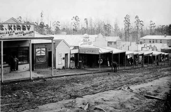
The discovery of coal in the 1880s transformed Korumburra into an industrial centre. The opening of the Great Southern Railway and the development of Coal Creek Mine marked the beginning of a new economy driven by extraction and energy production (Cannon 1981). Settlers built towns, farms, and infrastructure, reshaping the natural landscape to serve the demands of industry.
While this era brought prosperity to the colonial population, it also marked the loss of old forests, wildlife habitats, and cultural landmarks. The deep seams of black coal symbolised the exploitation of the very heart of Country — an inversion of Bunurong/Boonwurrung law, which teaches that land must be honoured, not mined for greed.
Ecological Memory and Renewal
Today, the Korumburra district is experiencing a quiet renewal. Many areas once cleared or mined have been rehabilitated through reforestation, wetland restoration, and sustainable farming initiatives (DEECA 2023; Parks Victoria 2023).
Community conservation groups now work alongside the Bunurong Land Council Aboriginal Corporation (BLCAC) to restore native vegetation, map cultural sites, and teach the next generation about Indigenous land management and history. Local schools and environmental organisations participate in on-Country education, reintroducing traditional language, plant use, and seasonal awareness.
This collaboration between Traditional Owners, scientists, and the local community reflects a broader movement of reconciliation and ecological repair. The same principles that guided Bunurong/Boonwurrung stewardship — respect, reciprocity, and balance — are finding new life in modern sustainability practices.
As Elder N’Arweet Carolyn Briggs has said, “When we name the land again, we awaken it; when we walk it with care, it speaks back.” In this way, the hills of Korumburra are learning to speak once more.
Modern Korumburra: Listening to Country
Today, Korumburra is a thriving town that balances history, agriculture, and natural beauty. Its heritage buildings, dairy farms, and the Coal Creek Historical Village stand alongside reforested hills and protected reserves that tell stories far older than the mine or the railway. Beneath the layers of industry and modern life, the old laws of Country still flow through the rivers and soils.
Under the stewardship of the Bunurong Land Council Aboriginal Corporation, projects across South Gippsland are reconnecting cultural knowledge with environmental management (BLCAC 2023).
By reviving language, place names, and ancestral understanding of waterways, Traditional Owners are helping to guide regional planning and ecological restoration. These partnerships show that modern progress can coexist with ancient wisdom when the law of Country — the law of listening — is honoured.
Conclusion
Korumburra, the heart of the South Gippsland hills, embodies both transformation and endurance. Its volcanic soils speak of creation through fire; its rivers carry stories of continuity and care. From Indigenous stewardship to colonial upheaval and modern restoration, the land has absorbed every change yet continues to breathe with life.
The meaning of Korumburra — “the place where Country speaks” — remains true today. Its voice echoes through the magpies’ morning call, the wind across the ridges, and the community’s growing awareness of its deep-time history.
As the region continues to heal, Korumburra reminds us that Country is not silent; it is always speaking. When we listen, we become part of its renewal.
References
Barwick, D. (1998) Rebellion at Coranderrk. Canberra: Aboriginal History Monograph.
Blake, B. (1991) Wathawurrung and the Colac Language of Southern Victoria. Canberra: Pacific Linguistics.
Broome, R. (2005) Aboriginal Victorians: A History Since 1800. Sydney: Allen & Unwin.
Bunurong Land Council Aboriginal Corporation (2023) Bunurong Sea Country and Cultural Water Plan. Melbourne: BLCAC.
Cannon, M. (1981) Life in the Country: Australia in the Victorian Age, 1840–1890. Melbourne: Nelson.
Clark, I.D. (1990) Aboriginal Languages and Clans: An Historical Atlas of Western and Central Victoria, 1800–1900. Melbourne: Monash Publications in Geography.
Clark, I.D. & Heydon, T. (2002) Dictionary of Aboriginal Placenames of Victoria. Melbourne: Victorian Aboriginal Corporation for Languages.
DEECA Victoria (2023) Environmental Management and Cultural Water Policy. Melbourne: Department of Energy, Environment and Climate Action.
Parks Victoria (2023) Strzelecki Ranges and South Gippsland Management Plan. Melbourne: State Government of Victoria.
Presland, G. (1994) Aboriginal Melbourne: The Lost Land of the Kulin People. Melbourne: Harriland Press.
VandenBerg, A.H.M. (1999) Geology of Victoria. Geological Society of Australia, Special Publication 10.
Zola, N. & Gott, B. (1992) Koorie Plants, Koorie People: Traditional Aboriginal Food, Fibre and Healing Plants of Victoria. Melbourne: Koorie Heritage Trust.
Written, Researched and Directed by James Vegter (22 September 2025)
MLA
Sharing the truth of Indigenous and colonial history through film, education, land, and community.
www.magiclandsalliance.org
Copyright MLA – 2025
Magic Lands Alliance acknowledges the Traditional Owners, Custodians, and First Nations communities across Australia and internationally. We honour their enduring connection to the sky, land, waters, language, and culture. We pay respect to Elders past, present, and emerging, and to all First Peoples’ communities and language groups. This article draws only on publicly available information; many cultural practices remain the intellectual property of their respective communities.